Satellite-Finder-App
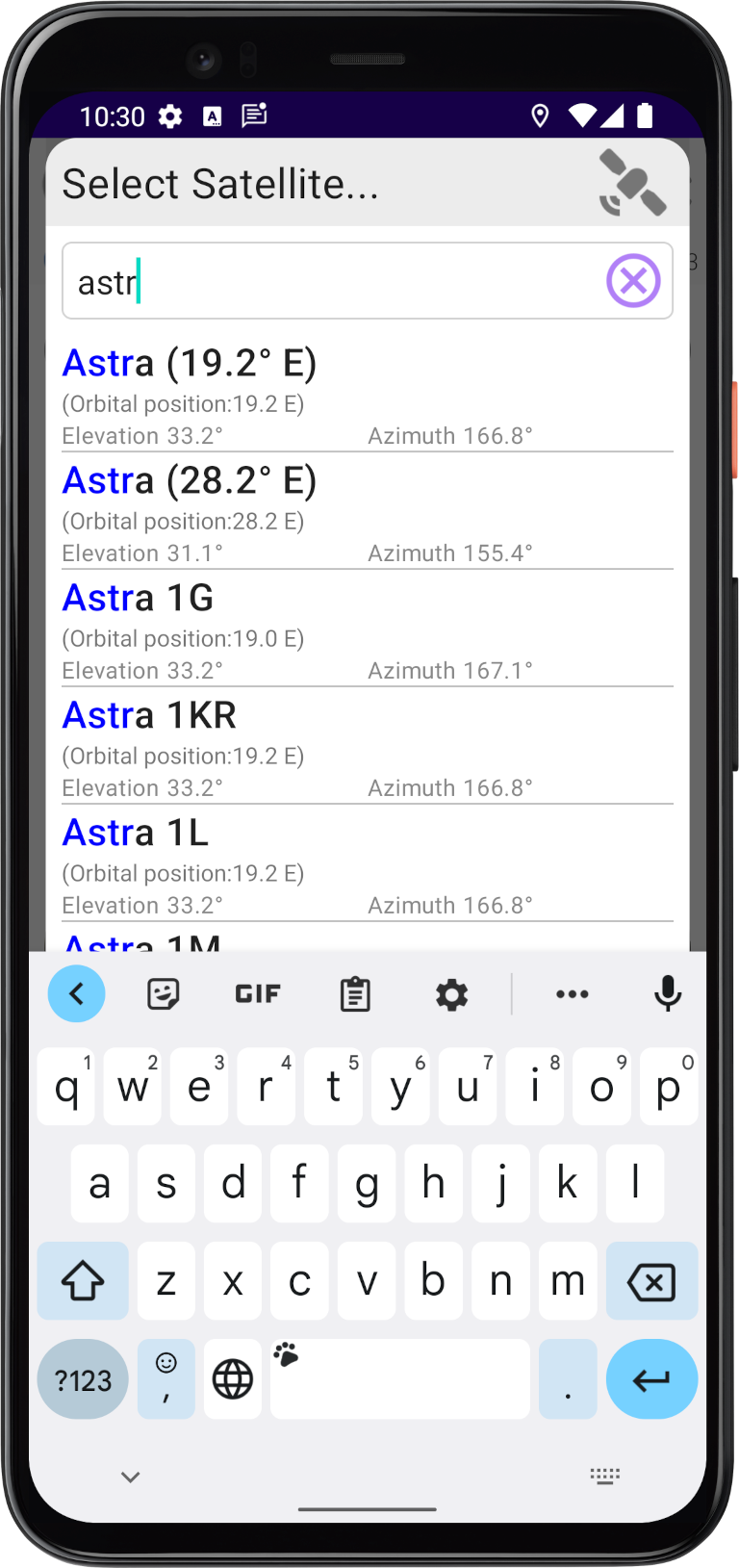
The app "Satellite Finder" helps you to quickly and safely align your satellite antenna to the satellite of your choice. First of all you have to select the satellite you want to align your satellite antenna on. Therfore, simply tap on the button and
afterwards a list of all satellites witch are available at your location is displayed...
and
afterwards a list of all satellites witch are available at your location is displayed...
You can find detailed instructions on our YouTube channel:
"Aligning a satellite dish in just 1 minute"
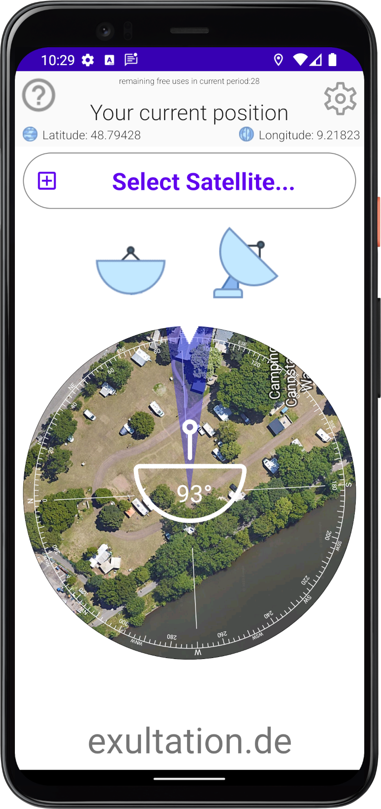
 to zoom the the map.
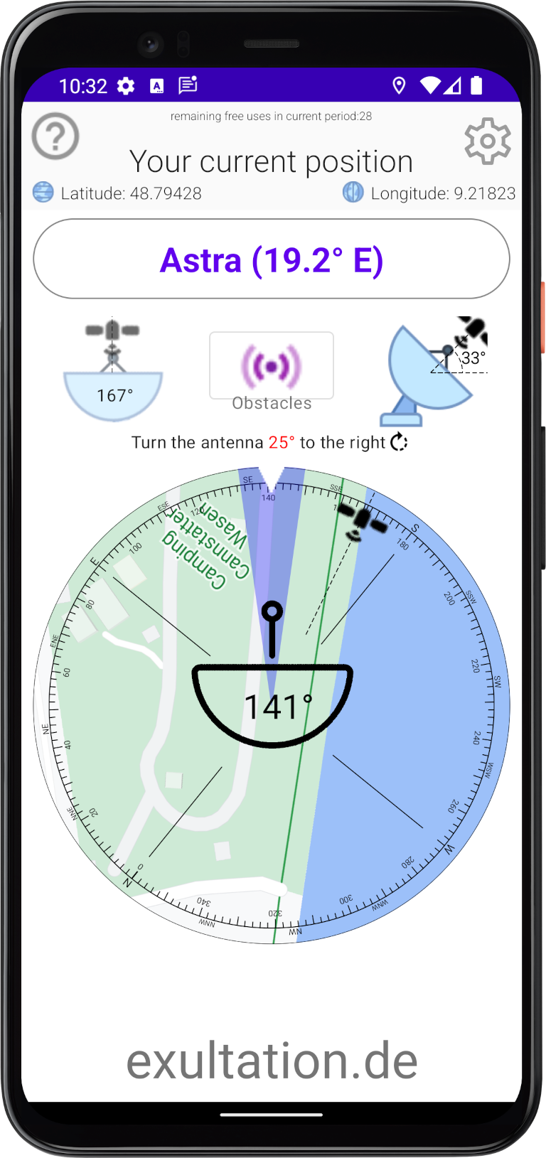
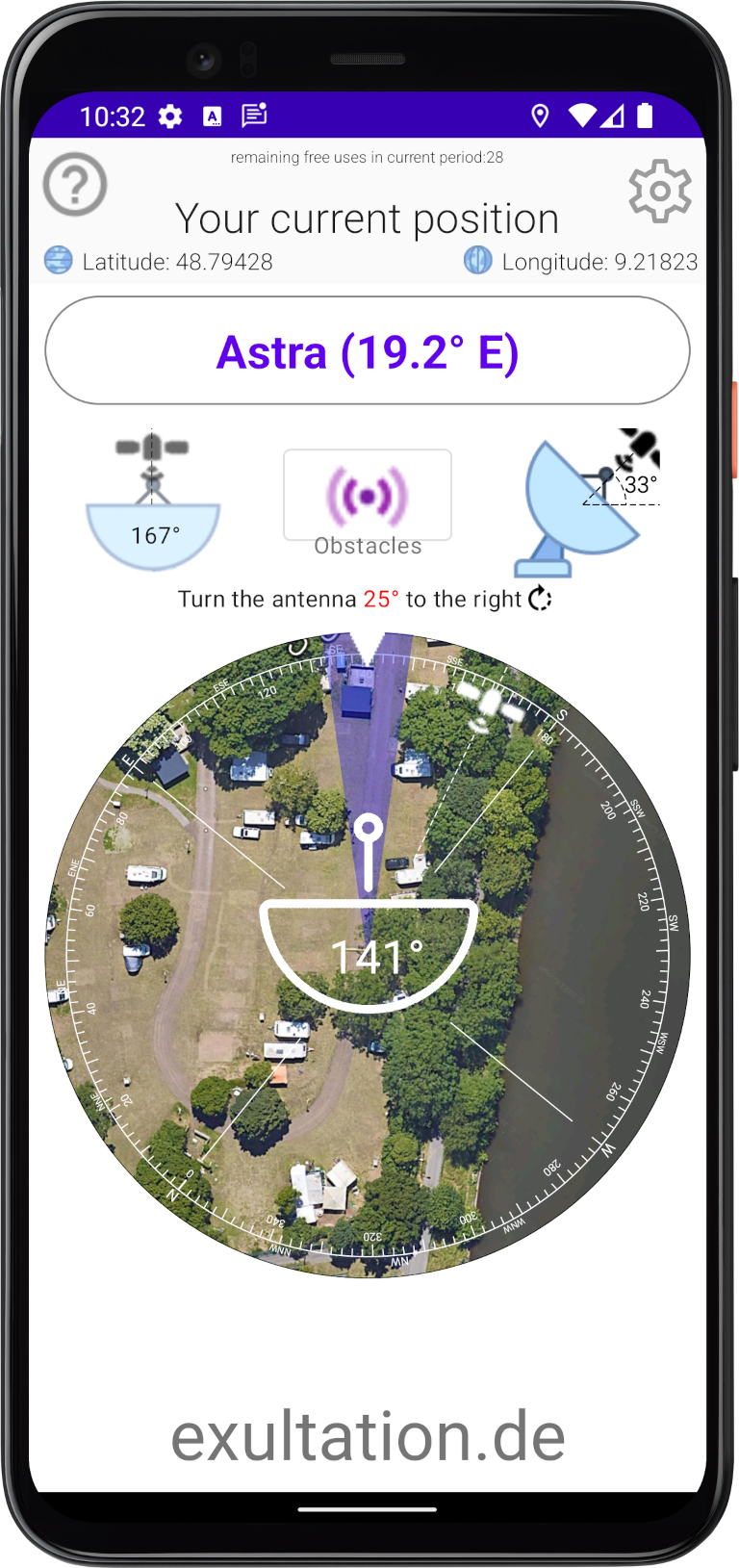
 to check whether you have a clear view of the satellite or whether there are any obstacles that could interfere with reception.
 icon at the top right of the app.
Now select the satellite to which you want to point your antenna. As soon as the symbol
icon at the top right of the app.
Now select the satellite to which you want to point your antenna. As soon as the symbol  is displayed, you can start aligning the antenna.
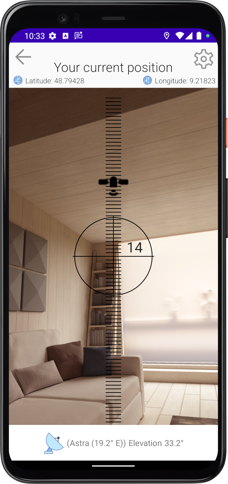
 of the targeted satellite.
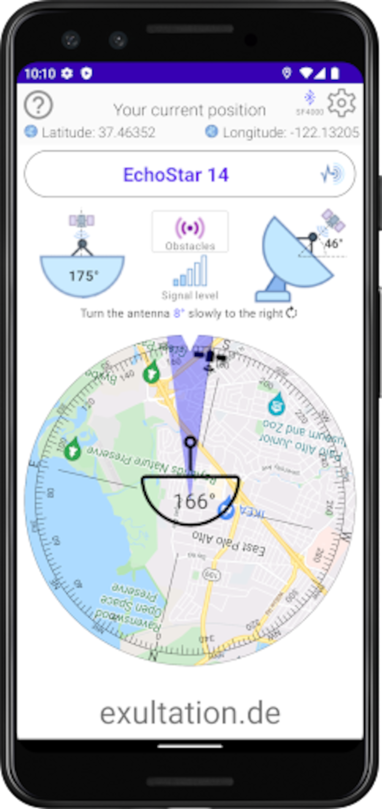
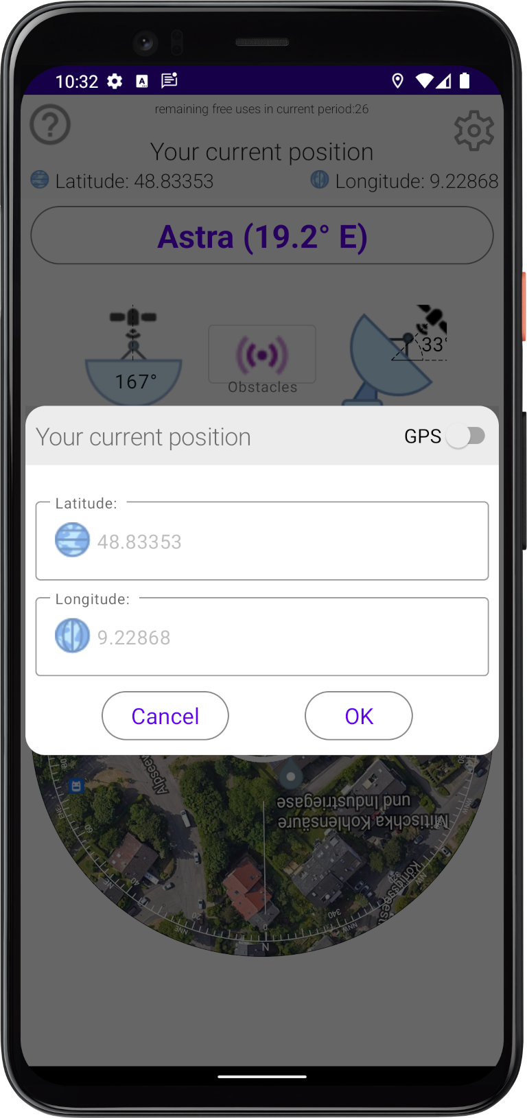
 in the upper right corner or the longitude/latitude image at the top
  , to open the settings dialog.
 to switch between automatic position determination and manual position input.